
Most of South Africa is a summer rainfall area, November to March, while the Western Cape Province receives most of its rain during winter, May to August. Over most of South Africa, there is a definite rainfall pattern with rainfall increasing from west to east.
This is illustrated by the yearly rainfall difference between Port Nolloth on the west coast, 50 mm and Richards Bay, 1 000 mm at the same latitude on the east coast. The interior plateau, the eastern Free State, KwaZulu-Natal, Eastern Cape and Mpumalanga Provinces receive almost all its rain as thunderstorms (convective rains).
These convective rains develop because all these areas have enough heat in summer. In short, this warm moist air rises, cools down, then condensates and precipitates as thunderstorms. In the western part of South Africa, the rainfall is low because there is not enough moisture in the atmosphere for convective rains. Also, there is no significant orographic rain effect in the mountains along the western escarpment.
This is because air from the cold sea current do not hold most moisture and the coastal winds blow parallel to the mountains. Orographic rain is formed when moist winds are forced up the side of a mountain.
High Rainfall Areas in South Africa
South Africa’s highest rainfall occurs in the eastern and southern mountains such as the Drakensberg, from Limpopo, through Mpumalanga and KwaZulu-Natal to the northern parts of the Eastern Cape.
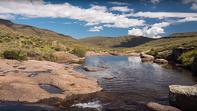
Other mountains with high rainfall include the Outeniqua Mountain, mountains of the South-western Cape and the Winterberg and Amatola Mountains, in the central parts of the Eastern Cape. The high rainfall in the mountains is due to orographic rains. The orographic rains of the mountain areas are extremely important for irrigation in arid farming regions sometimes hundreds of kilometres away.
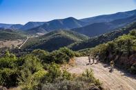
Runoff from the Drakensberg/Maluti Mountains of Lesotho and the Eastern Cape are fed via tunnels to irrigate the central and lower Orange River areas. A good example of orographic rains can be seen in the Eastern Cape around Alice.
The average yearly at Alice in the foothills of the Amatola Mountains is about 500 mm, but at Wolfridge in the mountains, the yearly rainfall is about 1 700 mm. The most extreme is at Wemmershoek in the mountains above Franschhoek, where the average yearly rainfall is more than 3 000 mm.
Cyclones and Cold Fronts
The high rainfall in KwaZulu-Natal and the north-eastern parts of the Eastern Cape is due to moisture-laden air brought in from the warm Mozambique current. Occasionally tropical cyclones develop, which bring devastating rains and floods.
The winter rains of the south-western and southern Cape are brought by cyclones or cold fronts. Cold fronts approach the Western Cape from the west, and pass over the province towards the east. These cold fronts bring days of soft rains, but the average annual rainfall in these areas is low.
A major reason for the low rainfall is that the moist air comes from a cold ocean, which results in low evaporation levels.
Special Rainfall Patterns
Deep valleys
A very important special geographic rainfall distribution pattern is found in the deep river valleys of the Eastern Cape and KwaZulu-Natal. These hot valleys have a much lower rainfall than the plateau areas between them. Due to higher temperatures in the valleys, there is a high rate of transpiration (plants losing water) and evaporation, which requires irrigated agriculture.
In the Sundays River Valley, the annual rainfall at Addo is only about 390 mm, and the highest temperature in South Africa was recorded at Kirkwood, 55ºC. Also, in the deep Keiskamma River Valley, the average rainfall at Dank den Goewerneury is only 390 mm, but it is 500 mm at Middledrift, nearby but outside the deep valley.
Mid-summer droughts
Summer rainfall areas are subdivided as having early, middle, late or very late summer rainfall. This indicates the month when the summer rain peaks not when the summer rain starts. The central Eastern Cape revealed an important special summer rain pattern; a small peak in spring and a fairly large peak in late summer/early autumn. In-between there is a mid-summer drought. Low rainfall and very high temperatures place water stress on growing summer crops.
Farmers must have contingency plans and strategies in place to limit losses and damage to crops during periods of limited water supply. Anti-transpirant sprays may limit water losses by transpiration.
These may be expensive and have negative side effects, such as reducing photosynthesis. In extreme situations, trees can be cut back to reduce the leaf area and limit transpiration. This was done in citrus orchards in the Letsitele area during the severe drought of the 1980s.
Source Water Research Commission