A Retrogressive State
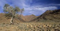
Far up in the Richtersveld, the Kuboes mission station was being presided over by the good Reverend Hein, of the Rhenish Church. The population was made up of Nama Khoikhoi, some Bushmen and a couple of Baster families (formerly known as Bastaards).

The settlement was controlled by a Groot Raad (great council), which was made up of community-elected representatives and chaired by the head missionary.
A contemporary report states that ‘the inhabitants of Richtersfeld count only 47 families, comprising say 380 souls, nearly all of whom are Hottentots, with Paul Links, son of the late Captain Paul Links, as their headman; their live-stock consisting of about 50 horses, 560 horned cattle, and 3,200 sheep and goats. Most of them are very poor, and I fear they are in a retrogressive state.’
The Groot Raad
The Groot Raad presided over the day-to-day affairs of the community. These included the ‘maintenance of order, settlement of disputes and granting of residence and grazing rights’. However, this system was not without its critics and the above-mentioned Mission Stations and Communal Reserves Act forced the separation of civic and religious authorities, replacing the missionaries with a secular Advisory or Management board (made up of white outsiders). The precise boundaries of this mission station (and, indeed, most mission stations in South Africa) were ill-defined.
By the 1890s, however, the people of the Richtersveld requested clarity on the issue as their land was being usurped by various colonial forces. They subsequently specified an area of nearly 700 000 morgen (600 000 hectares) as their traditional grazing land and requested an official ticket of occupation to guarantee their rights.
But Mr S. Melvill, Second Assistant Surveyor-General, had other ideas. In his report to Parliament ‘in regard to lands occupied by natives on certain Missionary Institutions and other places in Namaqualand’, Mevill stated that the land claim was much too large. He suggested reducing the land to 450 000 morgen (385 600 hectares) by excising most of the fertile land along the banks of the Orange as well as the coastal belt, which might be used for farming or fishing.
In the event, nothing was done about these recommendations, and no ticket of occupation was issued as the people were considered too primitive to look after themselves.
Despite the legal limbo, 5 farms on the coast were leased to white farmers in 1904. In 1919, a farmer named Cloete even tried to claim the whole of the Richtersveld as his own, which provoked a bemused response from the Rev. Hein who said that ‘Richtersveld belongs to the Community, no individual can claim it’. Then, when diamond fever struck in the 1920s, land around the Orange River mouth was leased to prospectors, even though this too was part of the original Richtersveld land claim.
By David Fleminger