The Geography
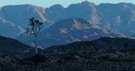
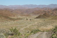
Before we being in earnest, let’s take a moment to familiarise ourselves with the geography of the area. In terms of location, the greater Richtersveld region can be said to form a rough square in the top left hand corner of South Africa.

The borders of this square are as follows: the western boundary is the Atlantic coast, from Alexander Bay to Port Nolloth; in the south, it’s the R382 road that runs from Port Nolloth to Steinkopf (a former mission station about 90 kms inland); in the west, it’s the N7 highway from Steinkopf up to Namibian border post at Vioolsdrift; and in the north, it’s the Orange River (or !Gariep, meaning ‘great river’ in the Nama language) and this major watercourse marks the international boundary between South Africa and Namibia.
Politically speaking, southern Namibia is not part of the Richtersveld, but ecologically speaking, it is very similar. On the South African side of the border, the closest major town is the dusty oasis of Springbok, about 60 km to the south of Steinkopf on the N7 highway.
A Concertina

The Richtersveld Community Conservancy is located in the middle of this square, bounded by grazing lands to the south and west, by the N7 highway and the Nababiep Nature Reseve in the East, and by the Vandersterre Mountains to the north. Beyond the Vandersterre Mountains lies the Richtersveld National Park, which extends to the banks of the Orange River.
The land between the coast and these two conservation areas is held in private hands and is mainly utilised for mining activities. If we widen out a bit, we will see that the Richtersveld is located in the top-left corner of the wider Namaqualand region. This is a maddeningly imprecise term that can be defined in different ways.
As Willem Steenkamp recounts in his memoirs, Land of the Thirst King, ‘The place is like a concertina. If you want to live inside its borders you stretch it out all the way to Vredendal. But if you don’t fancy being called a Namaqualander you squeeze it flat till it ends at Garies, and that’s that.’
The Succulent Karoo

Botanically speaking, however, Namaqualand is roughly defined as ‘the part of the Succulent Karoo that is strongly influenced by winter rainfall and fog’. Following this description, the southern boundary of Namaqualand extends from the mouth of the Olifants River, near Vredendal, to the edge of the Matsikamma Mountains at Vanrhynsdorp.
The eastern boundary then follows the Bokkeveld Escarpment, running between Nieuwoudtville and Loeriesfontein, and thence into the north-west, all the way to the coast at Lüderitz in Namibia. From a political point of view, however, the Namaqua District Municipality includes several environmental units that are quite distinct from the Succulent Karoo.
Thus, in the north, it runs along the course of the trusty Orange River from Alexander Bay to Pofadder (in Bushmanland). In the west, it follows the Atlantic shore to a point some 35 kms south of Garies. From here, it extends eastwards and somewhat south into the Hantam Karoo (including the towns of Loeriesfontein, Nieuwoudtville, Calvinia, Sutherland and Fraserburg).
Spring Flower Experience

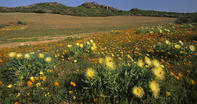
Finally, in terms of the wild flowers, these occur throughout the Namaqualand region, including the seemingly barren Richtersveld. You also get wild flowers south of Vanrhynsdorp, in what is technically the Cape Floral (or Fynbos) biome. Although they are several hundred kilometers apart, the towns of Springbok and Nieuwoudtville usually act the de-facto centres of the spring flower experience.
The emerging Namaqua National Park, near the town of Kamieskroon, is another good flower spotting area. The most notable flower destinations outside of Namaqualand can be found in the Cederberg mountains, along the coast around Elands Bay and in the West Coast National Park at Langebaan (the closest destination to Cape Town).
By David Fleminger