
Leliefontein to Rooifontein
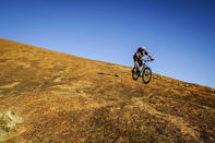
To the east and south of Kamieskroon, there are a series of gravel roads that lead through the mountains. These make for an excellent day trip with great scenery, interesting towns and several good flower sites (at the right time of year). And many of the local farms offer fantastic hiking and mountain bike trails for those with the energy.
You can also use these back roads to travel north to Springbok (via Gamoep and the gravel R355), south to Garies (via Leliefontein), or south-east to Loeriesfontein and Nieuwoudtville (via Platbakkies and the R355).
The town of Leliefontein, located in the middle of this under-explored area, is an interesting place to spend an hour or two. It was originally the kraal of a Nama chief, named Wildschut (wild shot) by the colonials. Unusually, it was granted to the chief by Governor Van Plettenberg in 1771, who turned down an application from a white farmer named Hermanus Engelbrecht in favour of the indigenous people.
The settlement of Kharkams, 25 km to the south of Kamieskroon on the N7, is an excellent flower spotting site. The name means ‘gathering place of the Nama near abundant water’ and is part of the old stock farmers’ route between Leliefontein and Bethelsklip (an archaeological site which shows evidence of human occupation dating back over 800 years). The huge boulders at Bethelsklip were also used as a pulpit from where Rev. Shaw gave sermons to the local Khoikhoi. This has given the site its alternative name, ‘Preacher’s Rock’.