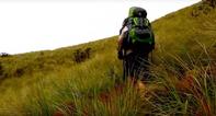
Because it’s There

Route: From the of the Contour Path below Cathedral Peak to the campsite above Didima Gorge.
Distance: 35 km
Duration: 2 days
Grade: Severe
General: This is probably the longest way you could find to get between these two points. Cathedral peak and Didima, or on to Monk's Cowl station, so why would you do it. 'Because it's there’, is the only answer I can give to anyone who asks. And I'm one of the people trying to champion a continuous contour path from Royal Natal Park to Bushman's Nek. If a four-day outing in the Berg is your aim, rather than just getting from one place to another, then this would be about the very best you could find. Go for it.
Shortest and Easiest Route

The shortest and easiest route between Cathedral Peak and Didima or Monk's Cowl would be to follow the eMhlawazini River upstream to its very beginning on Ndanjane Ridge, near Hhlathikulu Nek, and then under the Amphlett and down to Monk's Cowl. This is just 30 km starting at Brotherton store site, and makes a great - if less interesting and varied - two-day hike.
An Honourable Challenge
Take a map of the area and highlight the Contour Path with a magic marker. You'll notice just how convoluted the route is, going as it has to around every crinkle, wiggle and lump of the landscape. And this area is extremely crinkly, wiggly and lumpy. Consider Cathedral Peak Hotel to be the centre of a wheel, and the Contour Path to be the rim (well, only half a rim really).
From the beginning of the Contour Path in the north to where it reaches the Tryme Hill/Camel junction is 28 km. But you could walk to the base of the Camel from the hotel in just four, albeit steep, kilometers.
Anyway, let's presume you've decided you'd like to hike the Contour Path, maybe even set the challenge of linking up all the bits as far as you can from Mnweni to Sani Pass - now there's an honourable challenge for any hiker.
Straightforward But Certainly Not Straight
There's no real secret to this, other than that at one point it seems to disappear entirely and you have to scramble up a grassy gully at one of the Nyosi's tributaries and the bank is so eroded. But that's just how it goes.
From where the Contour Path begins to where the Mlambonja Pass route joins it is a pretty straightforward 7 km walk, from there it's 4 km to the base of the main pass. This is straightforward but certainly not straight. A further 2 km around Mount Helga brings you to a side junction to the left, going to Xeni Cave, and 1.5 km cutting back towards the Berg brings you to Xeni Pass.
The Tricky Part
The next 2 km are not nice, as this is where the path plays disappearing acts and at one point I lost it entirely. Somehow I found it by doing a 30 m scramble up insanely steep grass, but I suspect I was really off-route and therefore have decided not to say exactly where, and hope you fare better. On the map it's a lovely, wide path. Once past this tricky section the path suddenly reappears, as if by magic, and then it's another 5 km to the Tseketseke campsite and hut. This would make it one long day. Either make camp at the Xeni River 5 km further back, or start up the Mlambonja Pass route to cut off about 7 km to make it a 9 km day.
From the campsite at Tseketseke you start off up a steep, eroded grassy bank and into a side gully, but once you are there the going is easy for most of the rest of day two. The views are wonderful and the jeep track really easy walking. After 9.5 km you come to the continuation of Mike’s Pass, and it’s a further 3.5 km of up-and-down to The Nek.
The jeep track ends here and now you have to descend the steep Philip’s Folly (Philip van der Riet, perhaps). It’s a fairly taxing and winding 2.5 km descent down a rocky, protea-dotted series of spurs to the upper Didima Valley and the next overnight stop. The Little Saddle, Sphinx and Didima Dome are the luminaries in the crown of the Escarpment above. You might meet Basotho traders in the valley, casually scaling slippery Thlanyaku Pass in their gumboots.