'God's Window'
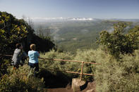
The reason the R532 was upgraded to a world-class, hard-top road back in the 1970s was to connect all the sightseeing dots along the incomparable Mpumalanga Highlands, or Eastern Transvaal as it was then known. It is now known as the Panorama Route, and with justification.
The famed Black Reef Quartzite Formation is a combination of quartzite, quartzitic conglomerate and shale that has up-tilted like a gargantuan paving slab. You can stand on the raised edge and look out over the Lowveld as the forested scarp drops away nearly 1000 m at your feet. And if you take a walk along the old Sefogane (Treur) River Trail towards Bourke’s Luck, you'll find the seldom-seen Devil's Window view, which is even more dramatic.
Bourke's Luck Potholes
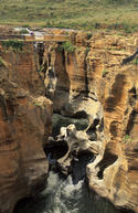
The popular Bourke’s Luck Potholes has become one of those “stop the car and take a quick photo” kind of place on the Panorama Route, but it wasn’t always that way.
Before they built the walking bridges over the potholes and make it look like a highway pit stop, people used to linger there, and even go for a stroll! If you walk a short distance upriver you’ll come to one of the biggest natural pools you’ll ever see. There are still some old mine workings around, so it will seem like you're back in the time of gold-seekers.
Mac-Mac Pools
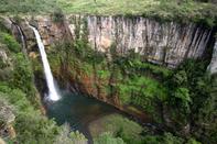
Not to be confused with the impressive twin falls just 3 km away, the pools are formed on the more-or-less open grassland of the Highveld plateau, near its highest point. A few small trees and impressive tree ferns line the stream and pools.
The pools are more bucolic than breathtaking, but their beauty lies in the tranquillity of their montane setting. It’s all very genteel, with grassy picnic spots and public toilets. Then again, not everything has to be completely wild to be enjoyed.
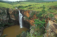
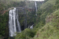
Berlin and Lisbon Falls
It is rather easy to get confused between these two falls, being so close to one another on Mpumalanga's Panorama Route as they are. You get home and try to remember as you look at the photos: is this Berlin or the…you remember the curio sellers, the scent of pine on the fresh mountain air, and the swallows swooping after mayflies in the updraft from the tumbling river… but Germany or Portugal? And yes, indeed, why those names at all. Even reference books and websites confuse them, and give heights ranging from 48 to 200 m.
For the record, Lisbon Falls is located about 3 km south of Berlin Falls; they're both close to Graskop but in a more rugged location. The easier way to tell them apart is that Lisbon is the double fall. Also for the record is that some early romantic forester decided to name the new plantations in the area after the various European capitals, and the waterfalls took their names from the plantations.
More falls worth visiting in the area are Sabie, Lone Creek, Bridal Veil, Horseshoe and, least known but maybe the loveliest, the Maria Shire Falls. We'll leave it up to you to find them. Further for the record: Berlin is 80 m and Lisbon 92 m.
