Epic Mountain Run
The Salomon SkyRun is an Epic Mountain run of 100 km, and is rated by many athletes as the toughest trail run in South Africa. The event is made up of two options: the SkyRun Lite (a 65 km one-day run) or the ‘Big Daddy’ 100 km SkyRun.

The event takes place in November and is unique in that it is self-supported, with all athletes expected to navigate themselves along the route.
The event is for serious and experienced trail runners only, with entries limited to 200 athletes for both race options. The 100 km run is not recommended if you are a novice/beginner trail runner, and proof of previous trail event finishes may be required. Rather opt for the 65km run presented on the same weekend.
The Terrain
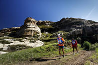
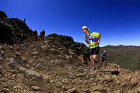
The Salomon SkyRun epitomises the true ideal of mountain running, with varying terrain along the network of jeep-tracks, hiking paths and off-track scrambling making up the 100 km route. If you have never done this race, familiarise yourself with the terms ‘self-supported’ and ‘route navigation’, as this will very much be in the hands of individual competitors.
Then there is the landscape here in the Wartrail / New England area. It is harsh to say the least, and very high, too (1 900 m in the valleys, and touching 3 000 m along some of the peaks). The landscape is windswept and baked by harsh sun in the day and icy conditions at night, with the cracked and brittle rocks underfoot telling a story of the extremes experienced throughout any given year. The region gets four or five heavy snowfalls between May and August, and the highest peaks are usually snow-capped throughout winter.
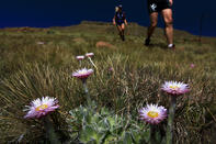
Once you have stepped beyond the town limits of Lady Grey, it is not uncommon to run much of the race without encountering any real traces of human civilization, except for the occasional support point or fellow racer. An impressive list of fauna and flora - including over 650 plant and 80 animal species – will add to a true lifetime event here within the incredible UKhahlamba region.
The Trail

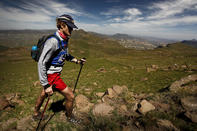
Both the Salomon SkyRun and SkyRun Lite are unique in that they are completely self-supported and self-navigational races. Athletes tackle the remote terrain of the Witteberg ranges with a map, compass or GPS unit, and a backpack containing all the food and water they require. A list of compulsory equipment will be supplied, and it is stressed during the race briefing that these items may be the only differentiating factor between life and death when operating racing within a harsh environment at an average altitude of between 2 200 - 2 500 m.
The events set off from Lady Grey, and the first 65 km of the route is the same for both races. A compulsory stop and medical check at Balloch will determine whether the Sky Runners can continue, while this is the end of the line for the SkyRun Lite competitors.
From the start, the route climbs sharply out of Lady Grey to the first Check Point at the Tower (12 km) along a combo of hiking trails and cattle tracks. Majestic views unfold below you as dawn colours the eastern skyline, while inquisitive cows track your progress along the steep, grassy ridges. Follow the fence line from here to the second Check Point at Olympus (22 km) traversing terrain devoid of paths or trails, and basically leaving you to decide on the best route along the grassy ridges.
A quick breather at Olympus will set you down on a faint trail leading to Snowden, the third Check Point at approximately 33 km. Look out for the natural spring just past Snowden and top up your water bottles and bladder - note the supply is dependent on rain fall though - before slogging up Avoca Peak, the highest point on the course at 2 756m. The ascent up Avoca is challenging, and the steep gradient and uneven terrain are sure to take their toll after a few hours on your feet.
Sky Runners are tough buggers though, and will persevere along the testing ‘Dragon’s Back’ ridge line lying in wait. This 3 m wide crest plummets steeply on either side, with fantastical rock formations stacking up into infinity and beyond on a clear day. Fortunately the route flattens out after this as you move towards Check Point 6 at Skidor, a leg of about 10 km. Prepare for a technical descent into the valley, then follow the river course channelling you into the compulsory stop at Balloch Caves (65 km).
Once cleared by the medical team, it is time to tackle the intimidating and near-vertical ascent up the Balloch Wall. You will climb more than 500 m over a matter of 3 km, hauling yourself up boulders and through sharp-edged tufts of chest-high spear grass. If you make it to the top, helter-skelter down the opposite side to CP8 at Edgehill Farm. The majority of athletes will now be well into the dark zone, a blessing after 12 hours in the harsh African sun.
Navigate your way through the Bridal Pass from EdgeHill and back onto the ridgeline, following a scramble along a pine-ridged spur to the left of the river course, (the Bridal Pass has now been included as a waypoint en route to assist athletes in negotiating this rather tricky entry point). A steady climb to the top will take you onto the ridgeline and a further Check Point at the Turn, from where you double back to Wartrail Country Club via Halston Peak (the final checkpoint along the route).
Athletes should take care on the rugged descent from Halston Peak, as fatigue from nearly a 100 km of mountain running will by now be seeping into their very bones. The fact that you may be doing this in the dark further contributes to the challenge, but the knowledge of the finish line within your grasp is sure to buoy you on to the welcoming Wartrail Country Club.

