Old Steam Railway Line
For the first 5.5 km the track West from Vrede Camp is pretty much dead straight and dead flat, then it dips down a side valley-let to the Touws River another 11.5 km form camp. Once you reach the river it's much prettier, even if it means you now have to move your mass against gravity because you are in fact going upstream.

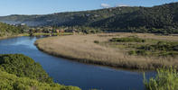
This is often hard to discern, because the landscape is much more featureless than dramatic, and if there is no water in the river you can't see which way it might flow. The prettiest spot is where the road crosses the river bed by a narrow causeway at the confluence of the Kruis River. You can make out an embankment up on the right, the remains of an old steam railway line dating back to who knows when. Road, river and railway run pretty together from here on.
At one point the track turns a sharp left-right-left around a vlei and farm dam. The track outside the reserve meets a more substantial gravel road at the first prosperous farms of the valley. About 8 km from the river crossing there is a skew junction and we turn right to follow the valley where it cuts a pass through a line of hills and crossing the river and old railway within the poort.
The next 12 km is rendered pleasant by the landscape “furniture” - hills, river, small cultivated fields, windmills and the like. In contrast, however, the next 20 are among the most mind-numbing kilometres between the Limpopo River and Atlantic Ocean.
The only relief offered is views of the distant Langeberg profile to the left and Hex River Mountains more or less dead ahead. This is very much a joining the dots kind of day, having to get from A to B, but not - it has to be admitted - the best riding day of your life, or ours. The first half is okay, the second not. Some days are like that. Some years are like that.
By David Bristow Anysberg Nature Reserve in the Western Cape is a little-known gem southwest of Laingsburg. The park was founded in order to protect the two ...